Mastcam-Z Skrinkle Haven mosaic (sols 721-729)
Posted by Jim Bell
[Note: The banner image and other views embedded in the text here are low-resolution 1/10th scale JPEGs, because the full-resolution versions of these mosaics would take a very long time to load on cell phones or tablets/laptops without high-speed internet access. For the full-resolution JPEG versions of this Mastcam-Z mosaic, in natural and enhanced color, and including a 3-D color anaglyph for red/blue glasses, click on the links near the bottom of this posting…]
This text is based on the NASA/JPL media releases for this mosaic, online at https://photojournal.jpl.nasa.gov/catalog/PIA25829 and https://mars.nasa.gov/news/9399/images-from-nasas-perseverance-may-show-record-of-wild-martian-river.
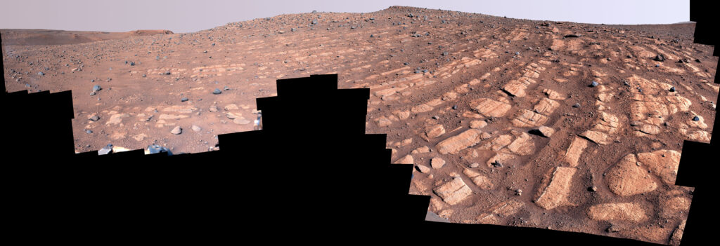
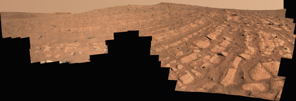
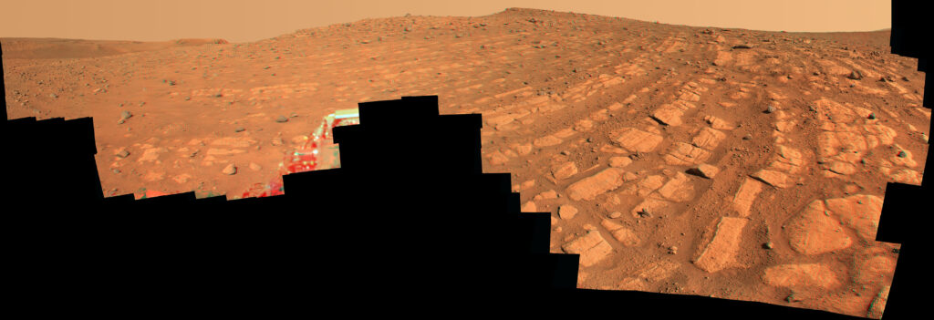
Scientists think that the bands of rocks seen in this image may have been formed by a very fast, deep river – the first of its kind evidence has been found for on Mars. NASA’s Perseverance Mars rover captured this mosaic at a location nicknamed “Skrinkle Haven” using its Mastcam-Z camera between Feb. 28 and March 9, 2023 (between the 721st and 729th Martian days, or sols, of the mission).
The mosaic is made up of 203 individual images that were stitched together after being sent back from Mars. The natural color view is approximately how the scene would appear to an average person if they were on Mars, and the enhanced color view exaggerates subtle color differences in the scene.
“Skrinkle Haven” offers the clearest example of these curved rock layers – called “the curvilinear unit” – that had previously only been seen from space. Scientists are now debating what kind of powerfully flowing water formed those curves: a river like the Mississippi, which winds snakelike across the landscape, or a braided river like Nebraska’s Platte, which forms small islands of sediment called sandbars.
When viewed from the ground, the curved layers are arranged in rows, and appear to ripple out across the landscape. They could be the remnants of a river’s banks that shifted over time – or the remnants of sandbars that formed in the river. The layers were likely much taller in the past; scientists suspect that after these piles of sediment turned to rock, they were sand-blasted by wind over the course of eons and carved down to their present size.
The name “Skrinkle Haven” comes from the bay of Skrinkle Haven in Pembrokeshire Coast National Park in the UK, where a number of spectacular layered sedimentary rock outcrops are exposed to view.
LOW RESOLUTION VERSIONS, FOR FASTEST DOWNLOAD:
LINKS TO FULL RESOLUTION VERSIONS, INCLUDING 3-D STEREO ANAGLYPH
1) Full-resolution, left eye, natural color (JPEG format; 43783×14997 pixels; 152 MBytes)
2) Full-resolution, left eye, enhanced color (JPEG format; 43783×14997 pixels; 236 MBytes)
March 9, 2023