2024-01-16
Take a Virtual Hike in Jezero with Mastcam-Z!
by Mastcam-Z Team members Sebastian Walter and Ralf Jaumann (Free University of Berlin, Germany)
https://maps.planet.fu-berlin.de/jezero
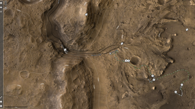
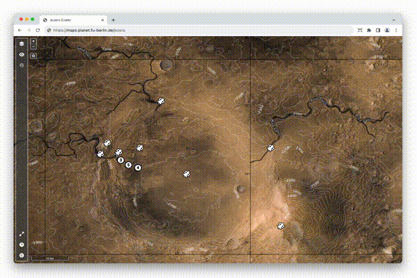
Prospective Mars explorers can follow the traverse of NASA’s Mars 2020 Perseverance rover with an interactive hiking map loaded with orbital images, terrain data, as well as synthetic and real 3D panoramic views of Jezero crater and its surrounding area. The map, which can be accessed through a normal web browser, is updated regularly with the newest 360° panoramas from the Mastcam-Z instrument.
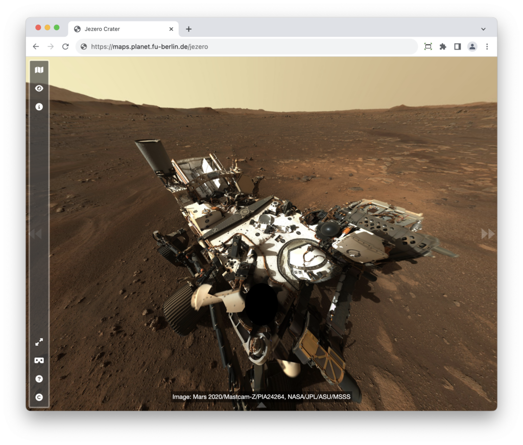
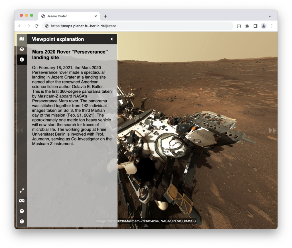
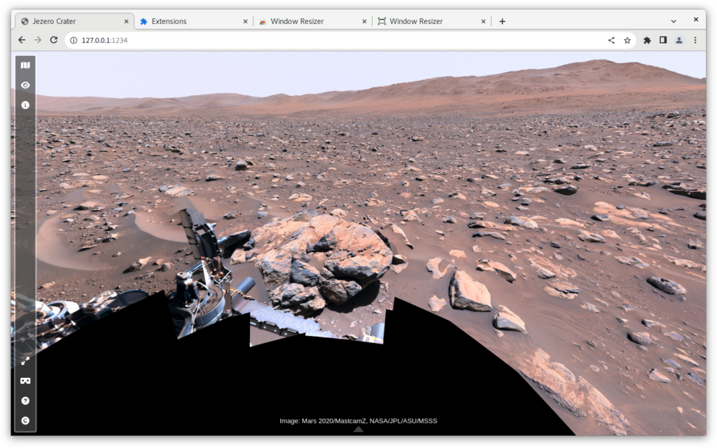
Imagine your future visit to Mars: This map above (and online here) is the perfect tool for planning your trip, with an interactive interface where you can choose from different available base datasets. Some of the slopes are pretty steep, so watch out for those if you want to avoid too much oxygen consumption! To get a real feeling of what to expect on your future Mars trip, you can click on one of the waypoint marker symbols to enter either a fullscreen 3D view or, if you have a Virtual Reality setup, to enter a fully immersive environment. You can even listen to the sounds of the rover if you stand close by, but please don’t touch it – otherwise you would contaminate the samples.
The map allows virtual hikers to zoom in and out, and pan rapidly across scenes, so that they can explore the landscape from large scales down to centimeter-detail. Some of the 360° panoramas integrated with the waypoints have been synthetically rendered from orbital image data (marked by a satellite symbol). Others are real panoramas stitched together from a multitude of single images taken by the Mastcam-Z camera instrument (marked by a camera symbol). When switched to the “panoramic viewer mode” of the map, you can comfortably zoom in and out of the panoramas. And you can click in the “information” icon to get more details about the scene.
If you have a virtual reality headset at hand, just open the link with the internal browser, and enjoy the fully immersive experience. The sounds you sometimes hear during the scenes are real sounds which have been recorded by the SuperCam instrument on that same rover mission. What you hear is mostly the rover making noises during its scientific tasks. Hint: if you keep your head still in VR-mode, the viewer will zoom in up to pixel level.
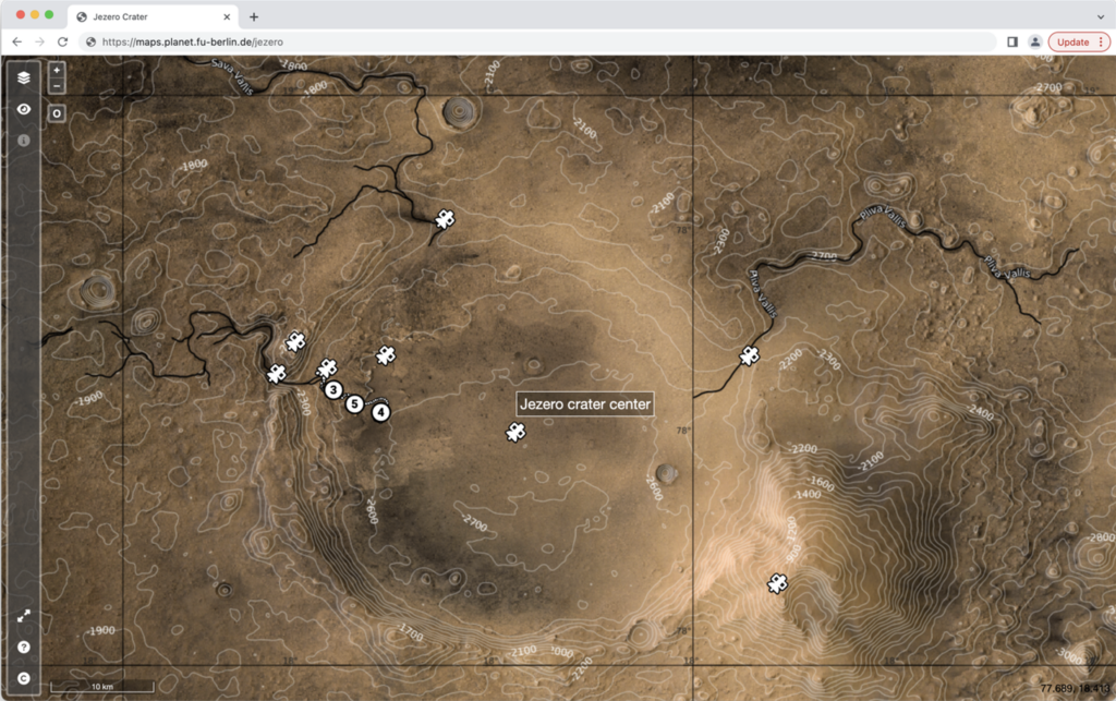
The base layer of the map is a merged dataset derived from three different instruments currently orbiting Mars: The High Resolution Stereo Camera (HRSC) on Mars Express, the Context Camera (CTX) and the High Resolution Imaging Science Experiment (HiRISE) instruments on Mars Reconnaissance Orbiter (MRO). The HiRISE data has been provided by the Terrain Relative Navigation (TRN) team of the Jet Propulsion Laboratory (JPL). The rover tracks, as well as the current rover position, are loaded in real time from the Mars 2020 mission server when you enter the scene. Another layer allows you to blend in a hypothetical lake level, which most likely once created the remnant deltas in Jezero Crater. The contour lines are dynamically rendered from the terrain model, which has also been assembled from the aforementioned three instruments.
The Jezero map builds on the data portal of the HRSC instrument of ESA’s Mars Express mission, which provides tools to visualize and disseminate large amounts of Mars images and terrain data in an online environment.
As the panoramic images are huge (e.g., the “Van Zyl Overlook” mosaic consists of more than 4.5 billion pixels), not all the data can be transferred to the client (which is the browser in this case) for viewing. Instead, the images are pre-rendered in several zoom levels, and only the parts from the current zoom level are transferred. Additionally, the images are divided into thousands of small patches called tiles. Now, when the viewer moves around the scene, only the relevant tiles are loaded, and they remain in the browser’s cache. Only new information has to be loaded from the server.
This short animation shows an example session:
Now hurry up and explore Mars before the trails are overrun by crowds of tourists!